Thursday, December 30

Planning "2011"

Yep, It's almost here! What does 2011 have in store for Florence County? We'll soon find out. First let's take a look back at some information we've shared with you in 2010 that will continue in the upcoming New Year:
  • 'The Environmental Protection Agency (EPA) proposes revisions to the National Ambient Air Quality Standards for Ground-Level Ozone' - This would strengthen the "primary" (designed to protect public health) and "secondary" (designed to protect sensitive vegetation and ecosystems) ozone standards, which could place Florence County in a non-attainment status. Florence County is currently marginally in attainment.

The Florence Area Transportation Study (FLATS) is the metropolitan planning organization for this area. The federal requirements and regulations on transportation planning for a metropolitan area in non-attainment will be strict. Everyone's support will be needed. The new standards are scheduled to be released by July 31, 2011. I'll keep you posted. In the meantime, if you'd like to learn more about this, take a look at EPA's website.

  • 'Alternative transportation and a multi-modal roadway network' - This is so important for all Florence County residents. Whatever your choice or necessity is for getting around in our awesome county, it should be easy and readily available for you. So let us know your thoughts on areas in our county that need transportation related enhancements.

Let me share the most recent resident request and the positive outcome. Some county residents whose choice of transportation is via bicycle utilize Highway 51 (Pamplico Hwy.) to reach their place of employment. The request was for more sidewalks. Well, SCDOT had a resurfacing project scheduled for Pamplico Hwy. from Freedom Blvd. to Howe Springs Rd. to be contracted out by the end of December, 2010. So, we contacted them regarding this request. No new sidewalks were included in the contract, only repairs to the existing ones. However, SCDOT advised if the City of Florence and Florence County desired, during the resurfacing project, they could enhance this roadway to a shared-use facility. The road is not wide enough to mark a bike lane, but the outside lanes could be widened to 14' to accommodate bicyclists. (like Hoffmeyer Rd.) The city and county have formally made this request to SCDOT, so look for this improvement soon. The resurfacing completion date is tentatively September 30, 2011.

  • 'Sustainability, Smart Growth, Livable Communities' - Yep, you've heard quite a bit about this and I told you it was just the beginning! There's a good possibility these initiatives could become federal regulations. The American Planning Association (APA) recently held a Federal Policy and Program Briefing and Planners' Day on Capital Hill. Take a look at the accomplishments of the last 20 months through the lens of APA's board-adopted legislative priorities:
  1. Support federal initiative promoting community livability and sustainability through enhanced planning;
  2. Adopt comprehensive climate change legislation that supports planning to reduce greenhouse gas emissions and address local adaptation;
  3. Transform federal transportation policy;
  4. Invest in rebuilding America's infrastructure;
  5. Help communities promote job creation, increase economic competitiveness, and build strong neighborhoods by taking innovative approaches to housing and community development policy;
  6. Promote energy efficient communities;
  7. Provide high-quality federal data for local decision making;
  8. Protect local planning authority;
  9. Advance the development of healthy, safe and active communities;
  10. Encourage strategic and sustainable investment through location-efficiency standards and expanded regional planning;
  11. Improve policies aimed at addressing the unique environmental, economic, and safety needs of coastal areas.

Wow, that's a mouthful! Each of these priorites are explained in APA's November edition of their planning magazine which can be accessed on APA's website. The goals in the recently updated elements of the Florence County Comprehensive Plan address many of APA's priorities in addition to other issues that are significant in order to achieve positive growth for our county.

So that's an off-the-top-of-my-head recap of 2010. Stay tuned for more to come in 2011! Happy New Year and thanks to all of our Florence County Planning blog followers.

Tuesday, November 30

Is Florence Ready for SmartCode?

A code for what? ...how smart is it?

SmartCode is actually a model form-based unified land development ordinance.

What? I got land development, but what is form-based? ...and what's an ordinance? ...and why is it a model? ...did you say 'unified'?

It is designed to create walkable neighborhoods from the most rural to the most urban. This type of development is economically sustainable and attractive. It puts more of an emphasis on "form" of development and less on "use".

Conventional codes contributed to strip malls, big box stores with enormous parking lots, fast food restaurants and signage/billboards that could be seen a mile away. Downtowns became deserted. Children did not feel safe walking or cycling and the elderly became dependent on others for daily needs. All of these combined created SPRAWL!

Smart Growth is an alternative to urban sprawl. New codes are necessary to allow for land conservation and to return to the more traditional patterns. This is best done by implementing the SmartCode.

Technical Descriptions for SmartCode:

Ordinance - An ordinance is an autoritative rule that allows the city/county to enforce the approved regulation.

Model Code - The model code is freeware and meant to be customized by planners, architects and attorneys.

Form Based - Form Based zoning has been developed to overcome the problems of sprawl created by use based codes. The emphasis will now be on controlling the urban form instead of controlling land uses. It envisions and encourages a particular physical outcome. While the physical appearance may not change, there can be many diverse uses.

Unified Land Development Regulation - SmartCode can include zoning, subdivision regulations, urban design, signage, landscaping, and basic architectural standards.

Walkable Neighborhoods - Towns and cities should be structured as a series of walkable neighborhoods. This requires a mix of land uses including residential, office and retail. Public spaces should reflect "outdoor" rooms. Pedestrian-oriented transportation design should also be addressed.

Rural-Urban Transect - SmartCode zones create habitats from very rural to very urban. The zoning categories offer a full diversity of building types, thoroughfare types, and civic spaces. Each has the applicable characteristics for its location.

Ridgeland in Jasper County was the first in SC and one of the first few cities in the country to adopt SmartCode as their governing code. Their SmartCode zoning ordinance can be viewed at the following website:
www.ridgelandsc.gov/...FinalRidgelandSmartCodeZoningOrdinance.20100318.pdf.

Is downtown Florence a candidate for SmartCode?

Monday, November 15

Shocking Bus News

Not only shocking, but cutting edge.
A 2006 DaimlerChrysler mock up of the diesel hybrid system.
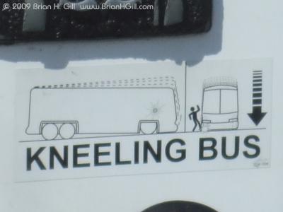
Just for illustration: please don't kick the bus:)
The Pee Dee Regional Transportation Authority (PDRTA to those in the know) have just landed a $3.2 million grant to purchase low-floor diesel-electric hybrid buses, and to improve PDRTA’s maintenance facility in support of their operation.

What does this mean, you ask?

Not only does it mean cleaner air for the area (we are close to EPA standards for ozone) but it also means better options for riders and PDRTA drivers. According to Janice Baroody, Executive Director of PDRTA, there are many riders that use wheelchairs. This low-floor bus kneels and deploys a ramp to greet wheelchair patrons. Ms. Baroody goes on the say that drivers won't need to deploy the ramp themselves, thus saving time on the routes.
What looks to be a GM hybrid diesel with a ramp.

What's left to do? PDRTA still needs to go through the public comment period for adding these funds to budgets, offer the project to bidding companies, then taking delivery. All in all, it will take another year or two before Florence is the only transit system with hybrid buses.

And one last note: two PDRTA riders, Casey and Ethan, make an appearance on http://wall.publictransportation.org/ telling their story of why they like transit.

Check it out. Report back. Let us know how we are doing.

Friday, November 12

Looking for information on Florence? Try the Comprehensive Plan.

A few days ago, I got a request for the GIS information on all of the public and private schools in Florence County. The GIS department has all of this information stored in a “Major Points File” but it hadn’t been updated in a while and also includes the location of the historic schools in the county, many of which are no longer open. I was wondering where to begin, when it hit me that probably the planning department at some point had put a list of schools together. I went and asked Debi, and she excitedly handed me the Comprehensive Plan.

The Comprehensive Plan not only has a complete list of all the schools (public and private), parks, and museums in Florence, but also a lot of other cool information. For instance, did you know that an Atomic Bomb (unarmed, thankfully) was accidently dropped in Mars Bluff (Cultural Resources Element, pg. 16)? If you are wondering what the soil type for your property is (there are over 50 in Florence County), or where to put your boat in along Lynches River, check out the comprehensive plan (Natural Resources Element, pgs. 10 & 40). If you want to know the median income, the Plan has that too (Population Element, pg. 20). Want to know what Florence County is doing to create bicycle and pedestrian networks? Check out the Transportation Element (pg. 37). The Comprehensive Plan also includes some really cool maps and pictures, some of which are shown below.

So the next time you catch yourself wondering about something in Florence, and aren't sure where to look, try here: http://florenceco.org/offices/planning/#comprehensive-plan. I went looking for a list of schools, and found out so much more.

Interested in the soil type of where you live? You can use this map, and the table that goes with it to find out soil type and what type of crops, if any, are grown there. (Natural Resource Element, pg. 9-10)


Information about boat launches along Lynches River (including the canoe launch location shown above) can be found in the Natural Resources Element.

Looking to visit a new park? The Cultural Resources Element has a comprehensive list of Florence County Parks and their location.

Friday, November 5

Round and Round They Go

Looks like a regular road with a large sidewalk.
I know we talk a lot about the importance of long range planning and how our team is looking forward anticipating more and more people moving, building, commuting, playing, and shopping in Florence County. One of our major exercises focuses on transportation planning. Throughout the nation (and the world) transportation planners are working to balance the need to move traffic with the desire to maintain local quality of life. Some may say these two things are the same, but others like things to stay the way they are.

There are challenges out there. I am sure most of you have seen the video of an 'intersection in India' where rickshaws, freight vehicles, motor bikes, cars and bicyclists successfully cross a busy intersect (sans signal). Some of our colleagues to the west are looking at a measured response to balance downtown redevelopment and maintaining the ablilty to move large agricultural machinery by way of downtown roads.

Locally, one of the intersections considered the epitome of 'needing work' is Five Points. Palmetto, Cashua, Hoffmeyer and Cherokee come together here making most likely the longest light timing cycle in the county (the shortest period of time I waited was less than 30 seconds but that was around 1:00am!). A recent update to the urban long range transportation plan (LRTP) considering upgrading Five Points to the Five Points Roundabout. Now, of course anything 'round' has no points; but my point is that this intersection has six, so everyone is entitled to a unique perspective. So, how about a little preview of how a roundabout looks and what it can do.

...but these strange markings tell a different tale.
These photos and the following video were taken from the Coastal Carolina University campus while on my way to a conference. It's really amazing how well the roundabout works. I entered the campus from 544 and there was a very long line to exit at that signal. This intersection, however, was flowing very well (even with bus traffic). Watch one of the buses take a left by going right (Lightning McQueen?) around the circle.


Notice there is a dominant roadway, but once a vehicle is in the circle, they have the right of way. Also notice how far back the pedestrian crossing is from the intersection - the markings make it obvious to drivers that pedestrians come first in this setup.

Now that's not so bad, so let's get your feedback. Do you think a roundabout will work for Florence? Have you experienced this roundabout? Thank you!

Wednesday, November 3

Calling All Gardners! Another Sustainability BLOG?


Yep, you read it correct, another sustainability blog! It's so important, I can't contain myself. I have to share things with you as I am introduced to them. Have any of you ever heard of Hurricane Leon? No, not a storm! He is a Florence resident whose place of business is just a few blocks north of Lucas Street on North Irby. (Look for the boat with the huge fish on it at the edge of his property)

The Planning Services Department had the opportunity to meet him, visit his facility and listen to him talk about something he is very passionate about. He operates a small vegetable farm and has started experimenting with organics, (foods that do not contain chemical pesticides), hydroponics (a method of growing plants using mineral nutrient solutions in water, without soil), and aquaculture (involves cultivating freshwater and saltwater populations under controlled conditions). He has chickens, a rooster named "Max " (what a set of lungs he has!) and bee hives that he maintains.
If you're interested in seeing his facility and listening to his wonderful passion, I'm sure he would be delighted to hear from you. (hurricaneleon@aol.com.)

Mr. Crump is the director of the Federation of Southern Cooperatives/Land Assistance Fund's state office in Florence. He is a member of the South Carolina Outreach Council and serves on the executive board of the National Family Farm Coalition. In 2002, he was appointed a Food and Society Policy Fellow, a national fellowship program designed to educate consumers, opinion leaders and policymakers on the challenges associated with sustaining family farms and food systems in the United States that are environmentally sound, health promoting and locally owned and controlled.

Mr. Crump assisted Williams Middle School in starting a Community Garden that the students learn from and maintain. It's awesome!

Keeping in line with Mr. Crump's passion, Eat Smart Move More (ESMM) Florence Chapter, in association with the South Carolina Public Health Institute and Francis Marion University's Advancing Rural Community Health (ARCH) are hosting a Home & Community Gardening Forum & Panel Discussion on November 9th from 5:30 - 7 p.m.. It will be held at Francis Marion University in the Lowrimore Auditorium. The speaker will be Carrie Draper, MSW who is the Healthcare organizer with S.C. Fair Share. Mr. Crump will participate on the panel. If you're interested in learning how to start and sustain a home, school or community garden, this is the event for you on November 9th.

Monday, October 25

Homeless in 2009

In January of 2009 , more than 643,000 people were homeless in the United States. Two-thirds were in shelters while the other third were on the streets or in abandoned buildings. Sixty three percent were individuals and the remainder were members of homeless families.

From October of 2008 through September 2009, almost 1.6 million individuals had taken refuge in emergency or transitional housing. Thirty nine percent of this homeless population lived in California, New York and Florida where high housing costs contributed to the problem.

Below describes the makeup of the typical homeless population:

  • 78% were adults;
  • 61% were males;
  • 62% were members of a minority group;
  • 38% were 31 to 50 years old;
  • 64% were lone individuals; and
  • 38% had a disability.
Between 2007 and 2009, homeless individuals declined by 7 percent and homeless families increased by 30 percent.

On January 29, 2009, there were 295 homeless persons in Florence County and an additional 105 homeless persons in the Pee Dee Region. There are two soup kitchens located in Florence:

  • House of Hope of the Pee Dee located at 1020 W. Darlington St.

  • The Manna House at 450 Jarrott St.
Also, the Harvest Hope Food Bank is located at 2513 W. Lucas St. and depends on donations to stock their shelves. Recently they have made public requests for supplies because of the shortage.

The recession is sure to have an impact on the homeless population as statistics are updated!

Friday, October 22

I-95 Roadwork, Florence

Night time lane closures will occur in various locations north- and south-bound from mile marker 154 to 197 for guardrail repair over the next two weeks. As a reference, Dillon is exit 190, David McLeod/ I-20 is 160 and the exit for 341 is mile marker 146.

Wednesday, October 13

New form of alternative transportation

Do you have the Five Points traffic blues? I saw this parked on the library lawn today. No doubt someone's idea of alternative transportation. I had the privelage of riding in these regularly with a previous job - they are fun!


.

Florence County "A Step Ahead" Of Natural Disasters

Tornados, hurricanes, and floods! Disasters we hope will never come our way, but know the possibility is always there. How great is it that we can worry a little less knowing that Florence County departments are on top of the aftermath should we be subjected to one of these unwelcomed disasters!

That's right! The Florence County Geographic Information System (GIS) staff has developed a computer program (DART), which is a new damage assessment tool that will be utilized in the event of a natural disaster. DART stands for Damage Assessment Relay Tool. The program combines GIS data with tax assessor information and calculates the dollar amount of damage based on property value of buildings and structures. The beauty of the program is the time it could cut in obtaining federal aid for disasters. By utilizing this new program, Florence County Emergency Management is aware almost instantly how much damage has been done and the dollar amount. This information is critical to submit to the state and federal government since this information is one of the considerations as to whether or not a presidential disaster declaration is issued.

So how does this program work? For past disasters, both an inspector and an appraiser would travel to a site with a paper map, clipboard, pen and paper. On the map, they had to figure out what piece of property they were looking at when they came to a damaged area. Then they would write down the parcel number, the type of structure, amount of damage and the address - if they could determine the address! This procedure had to be done for each damaged location. This information then had to be taken to the tax assessor's office to process the estimated damage for the neighborhood. This alone took three days.

With DART, the inspector's use dash-mounted laptops to plot points and send them back to the emergency operations center wirelessly. DART provides drop-down boxes for each field and uses a Global Positioning System (GPS) to pinpoint a team's exact location with a view of the site from the air. That way if the house is gone or completely destroyed, they can still see what use to be there. Now, what would have normally taken days to complete will make the process faster and much more accurate. As we all know, there is always the chance that the wireless communications could go down. No need to worry for this operation, the data can be logged into the computers and uploaded later at the emergecy operations center.

The Florence County Emergency Management office ran a successful first test on DART in June of this year. DART's capabilities should also help disaster response teams adjust plans as new information becomes available and allow agencies at the emergency operations center to track the path of disasters such as hurricanes and tornadoes. With these coordinates plotted on maps, they can view wind patterns and where the damage occurred. This information helps them make decisions on opening additional shelters and where to send additional resources.

We can't prevent these disasters if they are in our path, but doing whatever we can to make the aftermath easier to deal with is a big thing! Hurricane Hugo and the long weeks following it certainly are not pleasant memories. Learning about DART makes me breath a little easier should we be faced with another similar to Hugo. Hope it does the same for you!

Friday, October 8

LaHood in Florence

Secretary of Transportation Ray LaHood with Congressman John Spratt.
It's not often and never anticipated to see the U.S. Secretary of Transportation in your hometown planning for transportation's future. The Secretary of Transportation is the head of the agency that provides funding for State and local transportation projects and, for the reason of today's meeting, larger national-scale projects such as I-73. So, that's is just what happened this morning. I got a tip late last night from a Darlington County colleague (thank you, Brooks) that explained that there was going to be a transportation roundtable at SiMT Friday morning.

The Planning Services team with Secretary Ray LaHood (from left, Renee Proctor, Elizabeth Ervin, myself, and Debi Matthews at the right of the Secretary.
Of course you know what I said: "what roundtable meeting on transportation at SiMT?"
So a quick search for the meeting came up with Secretary LaHood's appearance in the Pee Dee - only the second for this position. Then, since I was excited about a potential 'fun Friday' with my staff, I woke up and called them to see if they were interested! ...yes, they were interested (and were already awake!). And, plus our intern was going to go, which I though would be a fantastic experience to see government in action.

Deputy Secretary of Transportation  John D. Porcari, who LaHood said, "really runs the department." 
During his presentation, Mr. Secretary mentioned that the House Committee on Transportation and Infrastructure is compiling a reauthorization of the transportation funding bill (where FLATS, through SCDOT, gets it's guideshare funding) worth nearly $500 billion with a tenth of that being a "down payment" to begin with the larger, important projects that the President mentioned in Milwaukee on Labor Day.

All in all, a very eye-opening day with an audience full of elected officials, MPO staff members from GSATS (our Myrtle Beach colleagues, Grand Strand Transportation Study), directors and administrators of many of the jurisdictions that would be affected by the new interstate highway.

Exciting times here in Florence!

This blog was edited to correct the number of visits the Sec. of Trans. has visited SC.

Thursday, September 30

FLATS Policy Committee Pursues Options

The most recent FLATS (Florence Area Transportation Study) Policy Committee meeting was held this past Monday. The meeting revealed what we can expect regarding transportation in our area and what applications for enhancement grants have been submitted.

Enhancement grants are federal funds most often used for bicyclists facilities, pedestrian facilities, landscaping and scenic beautification such as streetscaping and also preserving the abandoned railway corridors. Eligible applicants include city and county governments in the FLATS area (Darlington County, City of Florence, Florence County and Quinby). SCDOT must approve the local government to manage the project by showing that it has adequate staff to meet federal requirements. The allocated amount for the FLATS area is $117,000 annually.

An enhancement project that prompted discussion was the enhancement of the Cheves St. corridor (shown in turquoise and labelled "A" in the map below) from around the railroad tracks west to Irby St. The City of Florence is investing $1 million in parking north of this street that will support the Performing Arts Center and planned museum. City plans show a change in the number of lanes of this corridor to provide a more pedestrian-friendly environment to downtown and these new facilities. The enhancement grant proposal also includes much needed landscaping and bike lanes.


Renee and Debi did this.
Another option is to enhance the Dargan St. corridor (shown in pink and labeled "B" in the map above). Some of the Committee members mentioned this street may be the focus for enhancement monies. This street is two lanes and begs for beautification that will be inviting to downtown. The Committee has requested City of Florence staff to incorporate Dargan St. in the plan. What is your choice?

Other discussion at the meeting included upgrades to S. Cashua from Second Loop to Knollwood Rd. The question is whether sidewalks should be included in the project in a location where currently has little walking traffic or is walking traffic light because there is no where to walk? With limited area to expand, would a bicycle lane be a better solution in this area? As you can see in the schematic below, lane designation near the shoulder acts as a more significant bicycle accommodation.

Courtesy of SCDOT
The Committee has asked SCDOT to determine a cost savings if sidewalks were omitted from this project. Weighing the pros and cons make for healthy discussions especially when there is a high dollar at stake. We'll talk more at the next FLATS Policy Committee Meeting.

What are your thoughts and concerns on the above projects?

Adventures in Planning

Hello Blogosphere! My name is Elizabeth Ervin, and I’ve been interning at the Florence County Planning and Building Department for almost three months now, and I have to say I’ve learned a lot. I started strictly working in the GIS department, going over the database of Florence County roads with a fine tooth comb to make sure that when firefighters, police officers, EMS, and other first responders head to a sight they have an accurate map to guide them.

A few weeks into my internship, I got asked to help proofread the Transportation Element of the County’s Comprehensive Plan. Reading this piqued my interest in planning, so I asked Scott if I could help out more often, and he was nice enough to say yes.

Since then, I have gotten to attend meetings on transportation planning, learn planning terminology, and even make a few cool maps that show areas of growth in Florence County. I have been bombarded with new terms and ideas, and have seen firsthand all the work that goes into county planning.

Currently, I am working with a planning program called CommunityViz. CommunityViz allows for the visualization of future patterns of growth based on different scenarios. You can input zoning types, unbuildable areas, current building footprints, and other existing information. Then you can specify certain scenarios, for example changing zoning type or building of new roads or other infrastructure, and the program will predict what will happen to the area in the future. It’s really cool stuff, and especially great because I get to combine GIS with planning! It’s taking some time to figure out, but with the help of Rony (a super-talented GIS Technician), it’s getting there.

Working for the Planning department has been quite an experience so far, and I can’t wait to see what’s in store for me next!

Tuesday, September 21

Eat Smart Move More Florence Chapter

Everyday brings more and more pedestrian friendly events, goals to improve our infrastructure for drivers, walkers and bicyclist and committees formed to educate us on the importance of being given a choice of travel.

The City of Florence is continually researching ways to improve and expand our current Florence Trails System. The Eastern Carolina Community Foundation is constantly looking for grants and stakeholders to contribute to the health and wellbeing of all Pee Dee residents.

The Florence Trails Committee members are always brainstorming...
--where are the areas in need of connectivity to the trail system;
--where are new sidewalks or improvements to existing needed; and
--which roadways are utilized on a daily basis by residents to reach their
point of destination either on foot or by bicycle and what amenities are
needed for this road to make their trip as safe and pleasant as possible???

Of course, it takes money to achieve these brainstorming ideas, which we all know can be few and far between. But hey, at least the ideas are there when the 'green' is available.

The Federal Highway Administration (FHWA) has enhanced their regulations on transportation federal funding to promote sustainable, livable, walkable communities. The South Carolina Department of Transportation (SCDOT) is on the same page with FHWA, not only promoting these initiatives, but making safety and decreasing traffic congestion a top priority.

The Florence Area Transportation Study (FLATS) receives federal funding for transportation related projects. One of many documents FLATS is required to maintain and update on a regular basis is the Long Range Transportation Plan (LRTP). The FY2035 LRTP is in the final draft stages and will be presented to the FLATS Policy Committee on September 27th. The Policy Committee is the decision making body for FLATS. One of the ten chapters in this document regards bicycle and pedestrian facilities (Ch. 6). The entire document can be reviewed on the County Planning Transportation website. Look for more information on the adopted LRTP soon. Lots of information!

Florence County is fortunate to have numerous committees, businesses, schools, and stakeholders, just to name a few, jumping on the bandwagon with FHWA and SCDOT to promote safe, healthy, multi-modal options for us.

I thought you might be interested in learning of a recently formed committee in our area. Florence has just become a 'Certified Chapter' of Eat Smart Move More South Carolina (ESMMSC). The Eat Smart Move More Coalition is a result of a merger of the SC Coalition for Obesity Prevention Efforts (SCCOPE) and the SC Coalition for Promoting Physical Activity (SCCPPA). For more information on ESMMSC, check out their website .
The Florence Chapter anticipates their webpage becoming live in the next couple of months. It will be accessible through the ESMMSC website. Make a note to keep visiting this website and check out the things your local chapter is doing in our area.

Monday, September 13

Planning for the Pedestrian

The latest Florence plan for transportation has a significant focus on alternative ways to get around including by foot!

Downtown Florence improvements that lend to pedestrian traffic.

See the urban area plan here and County plan here.

Recent news from the past two months aren't the only indications of conflicts between walkers and drivers. Oftentimes, I personally see pedestrians crossing Irby Street at various locations to access the library, convenience stores or drug stores. On larger roads like Lucas Street, pedestrians use the shoulders to get where they want to go. There are still other clues of pedestrian use just by looking at the worn path along roads such as National Cemetery Road, Pamplico Highway and Palmetto Street. I am making my own path along Cherokee Road!

A road with limited pedestrian capacity.

There is little doubt that walking is an important mode of transportation.

Obviously, news reports on when pedestrian and car mix improperly usually result in a very bad outcome. Forty-five miles per hour and 3800 lbs. versus a 200 lbs person (I use my own weight, not yours) at 3 miles per hour has terrible odds when they meet. I hope I never find out what that feels like; and with those odds, I probably wouldn't. But I digress. There is a long list of issues that may not be readily apparent to a driver. Pedestrians are oftentimes walking in edges of unkempt yards and trash thanks to our faster transported cohorts (that's a whole other blog). Sometimes pedestrians walk uneven shoulders as is the case on Cherokee Road which has a steep side and a more flat side (although State Law says that you must always be on the left for two-lane roads). I opt for the flat side every time although I am not walking against traffic for half the time.
Some shoulders show signs of heavy pedestrian and bicycle use. 

Other issues include the obvious. Why would someone walk when they have a car (that is, if they have a car): it's either a desire to enjoy a walk through the park over waiting for the light to change, or a necessity. I know I contend with speeding traffic whizzing by, hoping they had their cup of coffee and see to avoid me. I hope the grass is mowed and the sprinklers are off as I walk to work. I hope turning vehicles don't mind waiting a few more seconds so I may cross. I hope the sidewalks I find are in good repair. I hope the suicide lane on Irby Street doesn't morph into a merging lane. I hope the temperature is below 75, but I would be asking for too much by that time. I wish Cherokee Road was a bus route.

In fact, if you live in more rural areas of the county, your transportation options are ever more limited and I am sure you would have to deal with higher grass at the least. In order to live outside of municipal limits, one would certainly need access to a car (or a neighbor with a car!). The American Association of Highway Officials (AASHTO) recently reported that improvements are needed to the "rural transportation system to keep agriculture, new energy products, and freight moving; improve access for the travel, recreation, and tourism industries; connect new and emerging cities; and to ensure reliable access to key defense installations..." However, the lack of multi-modal options in the report stirred the National Rural Assembly (along with YouthBuild USA, the Association of Programs for Rural Independent Living (APRIL), Redwood Coast Rural Action and others.) to counter that "public transit, regional, and inter-modal systems" should be included.

A typical cross-section and traffic of rural roads.

Even through the recent planning process, it's hard to determine the solution of where to utilize limited funds for multi-modal projects. Without much feedback from rural residents, can the assumption be made that everyone has a car there.  Or are rural areas among the only affordable locations to live with transportation continuing to take a bigger share of family income?

PDRTA waiting at the Timmonsville greenway.

Individuals and government agencies consider many factors when planning on that next house to live in or road to improve. What is your perspective on transportation priorities?

Monday, August 30

What I Learned on My Summer Vacation


Brisbane is a mostly a young city
 with decent architecture.
It's been a long time since I've used that phrase, but I did learn something this summer.

I visited Australia and I am very excited to share what I saw. [Yes, this is work-related]

I saw bicycles, catamarans, buses, trains, pedestrian bridges, taxis, hints of bicycle sharing, pedestrian only streets and parks (which I might highlight parks with a follow-up blog). Where did I see all this? The beautiful City of Brisbane, located in the southeast corner of Queensland on the country's east coast.

The city is a big one! The country's third largest city has over one million people spread over an area of 727 sq. mi. That's not quite as big as the entire Florence County area which is 799 sq. mi., but a lot more density than the whole Pee Dee region combined.

Mostly, I wanted to share photos that I took while tooling around the City and I'll describe what I could gather from my exploration. And, of course, if driving on the wrong side of the road has you worried, be comforted by the following alternatives...

Queen Street has been converted into a pedestrian street. No bicycles allowed. Note the overhangs to protect pedestrians from the weather. Mid-block cut-throughs were common as were shopping center-sized 'arcades'. The bus depot is located on the next parallel block consisting of a close series of designated stops.
CityCycle is a new program just starting for the City and some surrounding suburbs. Shown here is one of the pick-up, drop-off locations. In theory, a small fee would allow you to rent a bicycle. A rechargeable 'Go' card allows you get discounted prices to ride the bus, train, catamaran and utilize this service.
This is a pedestrian only bridge over Brisbane River. It connects the Queensland Technical College and Botanical Garden area to an neighborhood of green space, cafes, shops, apartments and offices. Note the bulb out portion of the bridge - there was a cafe there, too.
Probably one of the most exciting ways to travel was by catamaran. Since the Brisbane River connected the heart of the city as seen in the right of this photo to the arts district, Queensland University, Technical College, residences, shopping and parks, the catamaran was an efficient and fun way to travel or commute.
If you are still reading, then all these pictures were not just fun to do. In fact, this is what I would refer to as a technical photo. Yes, as a planner, this photo would be considered to embody the very intention of a complete street. Note on the left side of the photo the pedestrian walk including sitting areas, curb-outs for parking, bollards that protect pedestrians from vehicles and, what is that??; oh, trees and landscaping. Nice! Even the road where the peds cross is raised and has a different texture. Also noteworthy is the layout of the area: apartments to the right and to the left a large area park complete with gardens, main lawn, picnic area and amphitheater!
Pedestrian walkways along the Brisbane River within a park setting. Bougainvillea are trained to the sculpture-like boundary.  One of these parks included an artificial beach and water playground.
A riverside promenade. This turned into a roadway of bicycles, pedestrians and runners in the morning and afternoon hours. Note the sign which explains that walkers should stay left for bicycles to pass. Bicyclists use bells to make known of passing, too. Storey Bridge in the background includes a pedestrian lane - plus for fun, you can walk on the top!

Well, there you have it for now. I have a lot more photos; and hopefully, I can compile some that show the importance of public spaces, which Brisbane is full of. Until then, tell me what you think about these amenities and how we could possible integrate here.

Tuesday, August 17

PDRTA Continues to Expand Service

The Pee Dee Regional Transportation Authority is now providing a DART bus service to the City of Darlington. Let it be known that their stone gathers no moss! This service began August 16th and free rides are available through August 27th.

The residents of Darlington voiced their concerns about the lack of transit in this area and PDRTA listened. One major problem was no way for residents to get to doctor appointments or medical care.

DART will operate hourly between 7am and 5pm Monday through Friday. A one-way cash fare of $1 will also be offered.

Senior citizens age 65 and older ride for half price. Those with disabilities, Medicare card holders and children between the ages of 2 and 10 are offered the same half-price fare of $.50. There is no charge for children under age 2.

Route maps and schedules are available online at http://www.pdrta.org/. This information can also be found at the city's water department, the Greater Darlington Chamber of Commerce and Pearl Street Furniture.

Thursday, August 12

Highway Improvements For Florence County

Over the past several months, have you noticed sidewalk improvements, repaving of roads and maybe even some bridge repairs? These improvements are the result of The American Recovery and Reinvestment Act of 2009 (ARRA). The President signed this act in February, 2009 in an effort to improve our State's infrastructure and economy by saving or creating jobs.

The Federal Highway Administration while working with state partners, were able to meet the deadline of March 1, 2010 set by Congress to obligate 100 percent of the Recovery Act stimulus funds. What this means is $26.6 billion was committed to more than 12,000 road, highway and bridge projects across the country. In addition to putting our fellow citizens back to work, these projects are making our communities safer, greener, more livable, less congested and economically stronger.

Another accomplishment as a result of this Act is SCDOT's 2009 Statewide Sidewalk Enhancement Program. Enhancement funding in the amount of $2 million was reserved for sidewalk improvements in each engineering district. These funds are being used to construct new sidewalks and/or upgrade existing sidewalks to insure compliance with the most current standards with the American Disabilities Act (ADA).

Speaking of new sidewalks or repairs to existing, any suggestions? A representative from the Florence SCDOT office is a member of the Florence Trails Committee. We have begun compiling a list of areas that we feel sidewalks or repairs to existing ones are needed. We will present this list to the local SCDOT representative at our next meeting in October for their review. Of course, any project has federal eligibility requirements and there may be only one or two on our list that qualify, but hey, that's one or two more than we had before.

Send me your suggestions and I'll add them to the list. Even better, come join the Florence Trails Committee. We'd love to have you. You give me the word and I'll add you to the e-mail distribution list.

Thursday, July 29

Affordable Housing

South Carolina State Housing Finance and Development Authority (SC State Housing) has been there to aid many low income families, disabled persons and older adults for almost four decades. Their vision is to provide all SC citizens the opportunity to live in safe, decent and affordable housing.

The economy has certainly placed many citizens in a situation that they never thought they would be in. With unemployment resulting in foreclosure, many are faced with the problem of "no where to go".

Affordable Housing may still be a challenge for low income renters. Two questions are asked each year by the National Low Income Housing Coalition.

1. Could a full time job at minimum wage today support the affordability of a modest rental unit in the community?

2. How much would a family have to earn to to assure them of quickly finding an affordable rental unit? A unit is considered affordable if it costs no more than 30% of the renter's income.

Fair Market Value(FMV) in South Carolina for a two-bedroom apartment is $675. In order to afford this amount of rent and the utilities without paying more than 30% of income on housing, a household must earn $2,249 monthly or $26,992 annually. This income level translates into a housing wage of $12.98. This is based on a 40-hour work week, 52 weeks a year.

The following programs provide assistance for affordable housing and can be found in detail by contacting the South Carolina State Housing Finance and Development Authority at http://www.schousing.com/:

1. Mortgage Revenue Bond(MRB)Program
2. South Carolina Housing Trust Fund (HTF)Program
3. HOME Investment Partnerships (HOME)Program
4. Multifamily Tax Exempt Bond Program
5. Low Income Housing Tax Credit (LIHTC)Program
6. Section 8 Housing Choice Voucher Program
7. Contract Administration (CA)Program
8. Neighborhood Stabilization (NSP)Program

Definitions:
Cost-burdened: A household is considered cost-burdened when it spends more than 30% of monthly household income on either housing costs or rental costs.

Cost-burdened, Severe: A household is considered severely cost-burdened when it spends more than 50% of monthly household income on either housing costs or rental costs.

Fair Market Rent: A dollar amount set by HUD to determine the costs of renting a modest housing unit in a given market area (state, county, metropolitan statistical area).

Housing Wage: The hourly wage one would need to earn working 40 hours a week, 52 weeks a year in order to afford the HUD estimated Fair Market Rent for a given area while spending no more than 30% of monthly income on housing costs or rental costs.

HUD: The United States Department of Housing and Urban Development.

Low Income: A household is considered of low income when its income is between 51% and 80% of area median income.

Low Income, Very: A household is considered of very low income when its income is between 31% and 50% of area median income.

Low Income, Extremely: A household is considered of extremely low income when its income is 30% of or below area median income.

For more information, please contact the Housing Authority of Florence at 843.669.4163 or their website at www.hafsc.org. The Lake City Housing Authority can be contacted at 843.374.3541.

Tuesday, July 6

Sustainability, Smart Growth, Livability - WHAT? WHY?

"Sustainable Communities", "Smart Growth", and now "Livability". Phrases we're hearing more and more and will continue to. I don't know exactly how long we've been hearing them, but in doing some research, I found as early as 1998 with the Clinton-Gore Livability Agenda: Building Livable Communities For The 21st Century. If I did an intensive research, I'll bet I'd find these initiatives have been around much longer than that by a different way of communicating them, but the same meaning.

But why are they so important, and what do they mean? Their meanings are similar when it comes to transportation planning. Transportation is a critical link in creating more livable communities. It plays an important role in connecting affordable housing, good jobs, a safe and healthy environment, and strong schools, just to mention a few.

The US Department of Transportation (DOT) and the Federal Highway Administration (FHWA), look favorably on these initiatives regarding funds allocated for transportation planning. DOT's vision is "transportation policies that focus on people and communities who use the transportation system".

In June, 2009, the Partnership for Sustainable Communities was formed by the U.S. Department of Housing and Urban Development (HUD), the U.S. Department of Transportation (DOT), and the U.S. Environmental Protections Agency (EPA). These three agencies have pledged to ensure that housing and transportation goals are met while simultaneously protecting the environment, promoting equitable development, and helping to address the challenges of climate change.

Listed below are basic explanations of each along with websites containing more detailed information on each:

  • Sustainable communities identify a more compact and mixed-use, with a range of transportation options, less sprawl and more compact, walkable communities. (The United States Environmental Protection Agency (EPA) Sustainability webpage; The Federal Transit Administration (FTA) Livable and Sustainable Communities webpage)
  • Smart growth is more town-centered, is transit and pedestrian oriented, and has a greater mix of housing, commercial and retail uses. It also preserves open space and many other environmental amenities. (EPA Smart Growth Guide; Smart Growth America website.
  • Livability is tying the quality and location of transportation facilities to broader opportunities such as access to good jobs, affordable housing, quality schools, and safe streets. This includes addressing safety and capacity issues on all roads through better planning and design. (The U.S. Department of Transportation (DOT) DOT Livability website;The Federal Highway Administration (FHWA) Livability initiative website)

The Safe, Accountable, Flexible, Efficient Transportation Equity Act: A Legacy for Users (Public Law 109-59; SAFETEA-LU) is a funding and authorization bill that governs federal surface transportation spending. It was signed into law on August 10, 2005 and will expire the end of 2010. Congress is expected to begin working on a replacement bill for the next six-year period soon.

In a press release in April of this year, The American Association of State Highway and Transportation Officials (AASHTO) stated that DOT has indicated that livability is among the Administration's top priorities for future transportation funding. Soon it will be up to Congress to determine how "livability" will fit into the next multiyear transportation authorization legislation.

So you see, these phrases are here to stay and the initiatives behind them more than likely will become regulations for transportation funding. That's a good thing though. Just one more option on how to Florence County even better!


Thursday, July 1

Hold on, Florence!

New population numbers for July 1, 2009 are out from the Census for incorporated places and minor civil divisions, released June 22, 2010: (link: http://www.census.gov/popest/estimates.html)

We compiled the Florence County numbers here; and, well, there is little surprise that our area continues to slowly grow regardless of economic outlook - boom or bust. (Click this link: http://picasaweb.google.com/lh/photo/Ht2Y20lOsjbyjI-kL7TzoQ?feat=directlink, to see a larger version of the graphic below)


The 0.63% population increase for the County from 2008-2009 reflects the trend over the ten years that averaged 0.7% increase every year.

This environment makes for easier planning. What would happen if a huge influx of people began calling Florence home (Beaufort saw 400% increases)? A look at the County Comprehensive Plan will show what's possible.

As the Planning Services staff near the home stretch for updates to the Comprehensive Plan, I am confident that the County has tremendous room to grow - even within our current municipal boundaries. These locations are best suited for redevelopment and increased density simply because services like public transit, water, sewer, police and fire protection, parks, museums and schools are already provided.

Even with the modest population growth in Florence, we still have our growth challenges; but the smartest way to grow and live may also mean the most reasonably priced in the short term and long run. When considering your next move, think of closing the gap to amenities you treasure and utilize most. Then once you move, support those amenities so they may better serve you and your neighbor. We just may be the start of bigger moves to Florence County.

Health Costs and Transportation

A new publication, The Hidden Health Costs of Transportation, addresses how our transportation system contributes to our rising health costs and improving public health.

U.S. traffic fatalities and injuries are high on the list. One projection showed that in 2009 there were roughly 33,963 people that died in traffic crashes. That's only 1,783 more than the population of the City of Florence in 2009! The American Automobile Association stated that the costs of traffic crashes is $164.2 billion each year which is about $1,051 per person annually. Some hidden costs of transportation are physical inactivity, rising asthma and obesity rates, and poor air quality.

The design of transportation within the communities could be improved to introduce walking, bicycling and transit which contibute to physical activity. The American Public Health Association supports access to safe sidewalks, streets and playgrounds, health services and jobs.

The Hidden Costs of Transportation publication will be a recommending source for future transportation policy and investment.

Friday, June 18

Good, Bad and Ugly


First the good:
As I am reviewing the latest and greatest of FLATS long range transportation plan, I am constantly reminded of the great job our consultants have done with the analysis of urban Florence traffic. There is great detail (for a vision document) on how to think of a 'complete street' (Chapter 5, starting on page 5-69 ), financial constraints (we only have so many funds for FLATS, Chapter 10 page 10-6), and the initial approach to improve existing streets (Chapter 5 page 5-41) with medians, curbs and interconnections between businesses over the traditional - widen until you can widen any more! I also wanted to mention the fantastic public work ethic - we had a whole slew of residents and stakeholders whom met at public meetings as well as for advisory committees. Thank you, team!

the bad?
Yes, there is plenty of that in the document as well. Where are our sidewalks? How can we connect our rail trail to other parts of the urban area? When will Hoffmeyer Road be striped for bicycles? Can we get the traffic light timing on Irby Street correct? ...and don't even mention Five (six) Points and the location of the new downtown intermodal facility (one location where cars and bikes can park, buses are routed and trains stop)! There is a lot of work to do, and we are going to have fun doing it!

the Ugly.
Um, yeah - we have the ugly here in Florence. On more than one account by residents in public forums or blogs, the 76 corridor approaching downtown Florence from the airport is ugly. Other uglies also include a list of the worst crash rate intersections (above, from the County Comp Plan)

So, there's your brief rap up of one of the big projects we all have been working on - a good project that's a great direction to clean up the bad and ugly of Florence. Review the implementation plan; it's a quick read and lists what we could be proposing in the near future and many years down the road.

Tuesday, June 1

EPA's Clean Water Enforcement

The U.S. Environmental Protections Agency (EPA) is getting more and more serious about improving water quality and taking the steps necessary to keep Americans informed about the safety of their local waters. Before I give you the details on the EPA's most recent press release, here's a little background on The Clean Water Act (CWA):

The CWA was enacted in 1948 and was called the Federal Water Pollution Control Act, but the Act was significantly reorganized and expanded in 1972. Major amendments were enacted in the Clean Water Act of 1977and the Water Quality Act of 1987.

The CWA is the cornerstone of surface water quality protection in the United States. (The Act does not deal directly with ground water nor with water quantity issues.) The statute employs a variety of regulatory and nonregulatory tools to reduce direct pollutant discharges into waterways, finance municipal wastewater treatment facilities, and manage polluted runoff.

Now about the press release! EPA recently launched new web tools to inform the public about Clean Water Enforcement. The interactive web tools allow the public to check water violations in their communites. The purpose of this set of web tools, data, and interactive maps is to inform the public about serious Clean Water Act violations in their communities. These web tools are part of EPA's Clean Water Act Action Plan to work with states in ensuring that facilities comply with standards that keep our water clean.

The new web page provides interactive information from EPA's 2008 Annual Noncompliance Report, which pertains to about 40,000 permitted Clean Water Act discharges across the country. It also makes it easy to compare states by compliance rates and enforcement actions taken and provides access to updated State Review Framework (SRF) reports.

We all know that clean water is vital to our health, to our environment, and to our economy. Failing to protect our lakes, rivers and streams leads to the loss of irreplaceable natural resources, destroys ecosystems and endangers species. When I have spare time, which seems to be less and less these days, I enjoy reading speeches by EPA's Administrator, Lisa P. Jackson. Check this site out when you get a chance.

Don't forget to take a look at the three links regarding EPA's press release. Lots of information and a little overwhelming, but makes you think..... what little things can I do on a daily basis to help?

Friday, May 28

Rebates are still Available!

Hybrid rebates are available through June 30, 2010. This fiscal year we have only had one applicant compared to eight last year. The fund balance is $19,500. This rebate may or may not be approved again by County Council.

Our hopes are that the rebate will continue and all of the funding will be used thus increasing the population of hybrid vehicles in Florence County. It is no doubt that the economy has played a big role in the purchase of any vehicle but we hope that those of you who are in the market for a new car will consider a hybrid.

The main purpose of the rebate is to help reduce emissions in Florence County. Air Quality will definitely continue to be a topic for conversation due to new EPA ozone regulations. That will be another BLOG!

Please contact us or visit our websit www.florenceco.org for an application or information regarding the rebate.

We look forward to hearing from you!

Monday, May 17

Highway 51 (Pamplico Hwy) Widening

I recently attended a Public Information meeting on the widening of SC Route 51 (Pamplico Highway). There were probably 150 citizens in attendence all wanting to know how their property would be affected. The proposed widening extends approximately twenty four miles from S-57 (Claussen Road) near Florence, to US 378 (East Myrtle Beach Highway) near S-225 (Sandpit Road).

The purpose of this meeting was not only to supply the public with as much detail as possible but SCDOT wants to hear what the public has to say. This preliminary design offers much conversation for the land owner. The best way to express your concerns is to fill out the provided comment sheet. SCDOT will take all of these comments into consideration to make the best choices for all involved.

The proposal will consist of four lanes instead of two with a 15-ft paved median/left-turn lane. There will be 10-ft shoulders with 2-ft being paved and the other 8-ft grassed.

The total estimated cost of this project is $151.5 million. This will be the fifth project to be funded through a combination of Local Option Sales Tax and State Transportation Infrastructure Bank funds.

I heard pros and cons regarding this widening. Some of you felt that this is a much needed project that will benefit the growth of Pamplico and others of you felt that Pamplico would lose it's quaint charm.

If this widening project affects you, how do you feel about it?

Friday, May 7

Logging On Lynches River

I joined a group of Lynches River residents along with officials from The Department of Natural Resources (DNR), the South Carolina Forestry Commission and The Morning News on a kayak trip along The Lynches River near Johnsonville where a logging operation was recently completely.

I'm an 'every now and then' kayaker, but when I do go, my favorite part is floating along the more open portions of the river, leaning back and enjoying the peaceful feeling of seeing nothing but trees and the habitat amongst them. This particular trip was a little more challenging for me. The experienced kayakers took me through narrow areas and slews where my kayak was like a magnet to the trees. That'll teach me not to go but 'every now and then'!

Anyway, back to the purpose of the trip! Some local residents were concerned about the thin canopy in some areas as a result of the recent logging activity. You may remember from one of my blogs last year about this portion of the Lynches River being designated as a State Scenic River.

Logging operations are protected by State Law; however, logging activities are subject to state and federal laws concerning water qualtiy and maintaining an adequate buffer. A buffer is riparian lands maintained immediately adjacent to streams or lakes to protect water quality, fish habitat, and other resources. The South Carolina Forestry Commission's Better Management Practices manual suggests a 40' buffer remain between logging activity and a river. There is always that potential for the accumulation of sediment in the riparian areas, which in turn leads to possible impacts on water quality and fisheries. A well established buffer from open land serves as a point to retain such to eliminate it from reaching the water.

During the float trip, we did notice areas where the logged area was apparant through the canopy. The trees in these areas were small and spaced out, but the 40' suggested buffer seemed to be there. It did however, take away from the serene feeling of the river.

Logging operations are very important to South Carolina's economy. It brings in billions of dollars to the state annually, and provides employment to thousands of people. Water quality, and protecting our environment are important as well, so it's always good to expand our knowledge on the awesome benefits nature has given us and anything we can do to assist.

On a different note, I'd like to share something I witnessed during the trip that made me smile. Two mother ducks appeared a few yards ahead of us. They'd fly slightly above the water, then drop and fluttering in the water, then fly again. They continued this display every few feet. One of the kayakers explained to me that they were trying to get us to follow them so we wouldn't notice their babies at the edge of the canopy. When they are comfortable that we've passed where their babies are, they'll fly back to them. Sure enough, shortly after he told me this, we saw the babies swimming along the edge of the canopy and soon thereafter, the mother ducks were gone.

Ae you smiling yet? Maybe you had to be there!

Thursday, April 29

Freight Movement


A big part of the Transportation Element of the Comprehensive Plan is freight movement.

Last Friday we decided to spend most of the day following freight. Don't tell me you never thought about doing this! The purpose was to document routes, light timing problems, congestion, interstate access, speed, travel time from point A to point B and anything else that may be an obstacle for the hauler.

We first tracked a truck going southbound from Lucas St. at 10:00am. We tried to determine what his destination may be by the type of truck but were proven wrong. He passed Pet Dairy, McCall Farms and W.Lee Flowers before stopping at Carolina Eastern in Scranton at 10:30am.

You could tell that the driver was wondering why someone in a Florence County vehicle was following him so we explained the situation. He was willing to answer several questions pertaining to transportation and was glad that this was the only reason he was being followed!

We followed a flatbed truck at 11:05 from Scranton that appeared to be hauling a piece of heavy equipment. This truck continued until the destination of Nucor was reached at 11:53am.

Was his travel time reasonable from A to B? We did notice that there may be some signal timing issues going through Lake City. It's hard to stop in time at a light when you have just accelerated your speed from the previous light.

The next truck we followed was hauling lumber. We tracked him at 1:06pm from Williston to a lumber company off Francis Marion Rd. You could tell that the driver had made this trip many times before and did not seem to have any issues.

Our last hauler left Smurfit Stone at 1:45pm and continued past the Florence County line approaching Marion County at which point we turned around and returned to the office. We were trying to determine where his load had originated.

We came to the conclusion that milk and lumber are two commodities that seem to dominate the freight world in Florence on Fridays and perhaps Mondays may be a busier day for freight movement.

Beware of the vehicle following you! We want your feedback.

Thursday, April 22

What are Your Transportation Ideas?

We want to know and here's your opportunity to tell us! Could your concerns be congestion, speed limit too high, transit route needed, sidewalks needed, freight congestion, or ?????? There are no wrong answers!

Florence County Planning Department is in the process of preparing the Transportation Element. This document was recently legislated as an addition to the Florence County Comprehensive Plan. This element will examine the transportation facilities, including major road improvements, new road construction, transit projects, pedestrian and bicycle projects, and other elements of a transportation network.

This element must be developed in coordination with the land use element, to ensure transportation efficiency for existing and planned development. In addition, the plan considers the FLATS (the local metropolitan planning organization) long-range plan and future municipal plans.

Do you remember how much fun the 'let's play dots' land use map was? We received tons of input from you. Thank you! Let's play again! Maps will be on display at all six Florence County library locations and in the lobby at the Florence County Planning and Building Inspections Department, 518 S. Irby Street by Monday, April 26th. Just place your dot on the area of concern, number it and write your concern on your number on the 'Idea List' at the bottom of the map.

We're also hosting three public meetings in three different locations for your convenience. Pick one or join us for all...
  • Thursday, April 29th, 5:30-7:30 p.m., Lake City Senior Center, 198 N. Acline Street;
  • Tuesday, May 4th, 6:30 p.m. , Johnsonville City Council meeting, 111 W. Broadway St.;
  • Thursday, May 6th, 5:30-7:30 p.m., Drs. Bruce and Lee Foundation Library meeting room, 509 S. Dargan St.

We'll compile all of your ideas/concerns and present them to the Florence County Planning Commission on May 21st during their workshop on this element. We'll be looking for you!

Monday, April 5

A Blue Trail For Florence?

How awesome it would be if a portion of Jefffries Creek could become a Blue Trail! The Congaree, Wateree, Wacammaw and Reedy Rivers, are just a few Blue Trails you may be familiar with. Until I started educating myself on Blue Trails, I had no idea the length of Jeffries Creek. It's headwaters begin just south of Hartsville flowing through Florence and Darlington counties for approximately 34 miles before reaching the Great Pee Dee River. Pretty amazing!


Not familiar with what a blue trail is? It's water equivalent to a hiking trail benefiting paddlers, anglers, hikers, picnickers or for those of us just seeking a bit of solitude. I DO love group recreation, but ahhhh...., solitude!

Several interested Florence residents met for a brainstorming session recently. Representatives from American Rivers and Greenville County were there to offer suggestions and share their success stories. Research is on the way to see if this is a possibility. Lots of work would need to be done to make this happen. The group will meet again soon. If you're interested in attending, send me a comment and I'll make sure you know when and where.


Check out the list of SC Water Trails. Can we add Florence County to this list? What's your thoughts? More to come later........

Thursday, April 1

Florence Falling off the Census Ranking

A look at today's Census return ranking shows Florence lagging behind the statewide and national averages.

Check out our status: http://2010.census.gov/2010census/take10map/

Just perusing the map show that some of my colleagues in Aiken County are enjoying a 3 point lead over the Florentines!

We are running neck and neck with Charleston and trailing Greenville!!

Let's go Florentines - return those Census questions and get a gold star!

Friday, March 26

Watersheds: Easy as 04030201!


Where does your drinking water come from?

Obviously, clean water is essential to life. Watersheds supply drinking water, provide recreation and sustain life (just a little important, right?). Food, fiber, manufactured goods, and tourism depend on clean water and healthy watersheds, too.

Watersheds and drainage basins are natural ups and downs of the land surface that channel rainwater to a common waterway, such as a stream, lake, river, etc. The two major rivers in Florence County are the Lynches River and the Great Pee Dee River. The US Environmental Protection Agency (EPA) shows the watershed for the upper area of the County is named the Lower Pee Dee River Basin (numbered 03040201 in the graphic above), containing the Great Pee Dee River. The southern part of the County is part of the Lynches River watershed (labeled ...202), and as the name implies, drains to the Lynches River.

The Pee Dee River has a lot of work to do accepting drainage from Jeffries Creek, Catfish Creek, the Lynches River (yes, one watershed drains into another!), the Little Pee Dee River and the Black River Basin.

Federal water legislation dates back to the nineteenth century when Congress enacted the River and Harbor Act of 1886, recodified in the Rivers and Harbors Act of 1899. The principal body of law currently in effect is based on the Federal Water Pollution Control Amendments of 1972, which significantly expanded and strengthened earlier legislation. Major amendments were enacted in the Clean Water Act of 1977 and the Water Quality Act of 1987.

So you see, protecting our watersheds is imperative for our health and it's federally regulated! The City of Florence has recently completed a project with the help of a local Eagle Scout troop putting up these signs to educate residents on the importance of protecting our watersheds. There are approximately 15 signs installed noting to passersby of adjacent waterways.

Let's all join in the effort to protect Florence County's watershed!